
NEW: Onshore Inspections
The Flux
A robust handheld system for corrosion detection and 3D mapping of unpiggable pipelines.
Discover the Flux
Inspect The Unpiggable
NEW: Onshore Inspections
A robust handheld system for corrosion detection and 3D mapping of unpiggable pipelines.
Discover the Flux
NEW Service
Know how fast every coating defect corrodes, in µm/year, validated against excavations.
See how it works
FREE: Whitepaper
How CMI separates protected steel from actively corroding steel, without excavation.
Download
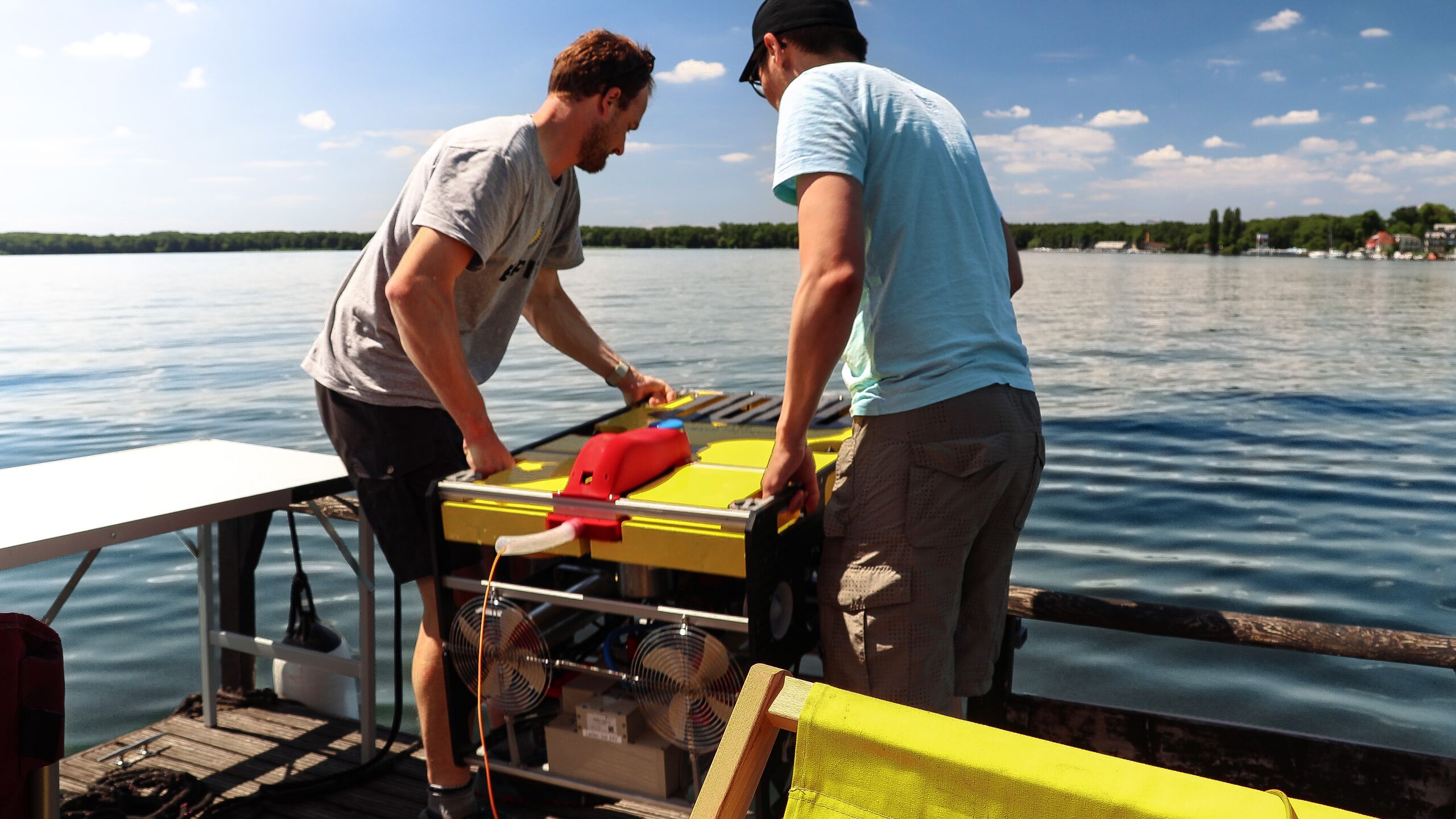
How do you inspect a water main that lies at the bottom of a lake, is covered in sand and cannot be pigged? In the research project TAUWIS, EMPIT, Fraunhofer IOSB-AST and the DVGW-Technologiezentrum Wasser (TZW) have developed a semi-autonomous underwater pipeline inspection system for exactly these unpiggable pipelines. The system combines EMPIT’s Current Magnetometry Inspection (CMI) sensor with a remotely operated vehicle (ROV).
In a field test in Lake Müggelsee near Berlin, the ROV traced a submerged water pipeline that neither camera nor sonar could see, and a leak was located. Berliner Wasserbetriebe and Zweckverband Bodensee-Wasserversorgung supported the field tests as associated partners.
Project partners


At a glance
Discuss your submerged pipeline
Water utilities operate pipelines in lakes, reservoirs and rivers: raw water intakes, lake crossings and inverted siphons beneath waterways. Many of these lines are unpiggable, and their route is often only roughly documented. Until now, operators have largely depended on divers to assess them. Diver missions are slow, expensive and carry risk for the people involved, and they reach their limits quickly in poor visibility.
Optical cameras and sonar only help as long as the pipe is exposed. Once a layer of sediment covers it, the outer surface disappears from view, and with it the information an operator needs to plan repairs.
Current Magnetometry Inspection measures and records the magnetic field of the electrical inspection current flowing along a conductive pipeline, without direct contact. On land, EMPIT uses CMI to locate pipelines and detect corrosion and coating defects from above ground. In TAUWIS, the technology was adapted for underwater use for the first time.

The CMI sensor system calculates the position of the pipeline in real time and passes it directly to the navigation system of the ROV. The vehicle responds to these sensor signals and automatically aligns its course with the pipe, so it follows the line semi-autonomously. Condition and position data are recorded in a single pass, non-destructively and without interrupting operation. The detailed evaluation then takes place in post-processing at EMPIT. There, the sensor data reveal corrosion, deformation and leaks and document the exact position of the line.
In summer 2026 the system proved itself in Lake Müggelsee near Berlin. A layer of sand covered the pipeline under investigation, so neither camera nor sonar could capture its outer surface. Thanks to precise navigation, the ROV still followed the route accurately, capturing the trajectory and geolocation of the pipeline. In addition, a leak was located, whose coordinates were handed over to the operator for repair.

The deployment demonstrated that the system follows pipelines reliably and locates damage precisely, even under difficult visibility conditions. For operators, this means robust information to prepare repairs in a targeted way and to limit water losses faster.

The field test took place on a water main, but the potential reaches well beyond water supply. With minor adaptations, the system can inspect pipelines in coastal waters, inverted siphons under waterways, and hydrogen, oil and gas lines.
On land, EMPIT inspects buried pipelines from above ground and reaches difficult sections such as water crossings from the air with the Black Copter drone. The CMI-guided ROV takes over where inspection from the surface reaches its limits. For buried water mains on land, see Water Main Condition Assessment from Above Ground.
TAUWIS was carried out jointly by Fraunhofer IOSB-AST, EMPIT and TZW, which coordinated the consortium. The project ran from September 2024 to August 2026 and was funded by the German Federal Ministry of Research, Technology and Space (BMFTR) under the “KMU-innovativ” programme.
Commercial deployments of the system have already been commissioned and will be carried out in 2026. In follow-up projects, the partners plan to add an AI-based edge computing unit. It would enable fully autonomous control and real-time data evaluation on the vehicle itself.
TAUWIS shows that a submerged pipeline does not have to be visible to be inspected. The CMI signal steers the vehicle, so the system follows buried and sediment-covered lines precisely and records position and condition in one pass. Costly diver missions give way to targeted repair data. For operators of unpiggable pipelines under water, that means less risk, plannable repairs and faster response to damage.
Unpiggable does not mean uninspectable, not even at the bottom of a lake.
Have a submerged or unpiggable pipeline to assess?
Press coverage (in German)